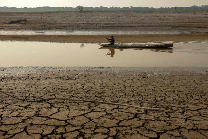
The region is particularly susceptible to coastal inundation, according to new research drawing on land elevation data
(AF) While the heatwave in the US Pacific Northwest has grabbed global headlines this week, tropical nations will face a more existential threat from climate change.
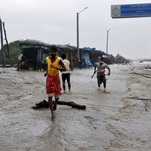
Asia-Pacific countries in particular are threatened by coastal inundation from a rise in sea levels, according to new research published on Tuesday in the journal Nature Communications.
Using land elevation data gathered by laser pulses beamed by satellite to Earth, scientists identified coastal areas low enough to make them vulnerable to a one-metre rise in sea level – a level the world is on track to see by 2100.
Higher water levels are likely to lead to more damage and disruption from flooding and storm surges. The team found that 62% of these low-lying areas were located in the tropics, with a third of the total in Asia.
Today, those vulnerable lands – at elevations that are less than 2 metres above sea level – comprise about 1 million square kilometres (386,000 square miles) and are home to 267 million people, the team found.
As sea levels rise, the total amount of vulnerable land could reach 1.46 million square kilometres by 2100, an area on which some 410 million people live today.
Already, the global average sea level is rising at more than 3 millimetres per year, accelerating as global warming melts glaciers and polar ice and expands the oceans.
Analysts are already accounting for an economic toll. Physical climate risks such as rising sea levels, droughts, floods and wildfires are credit negative for most rated sovereigns in Asia-Pacific, Moody’s Investors Service said in a report.
VULNERABLE AREAS
For some Asian regions, sea level rise is being exacerbated by land subsidence, as major cities including Jakarta and Bangkok pull water up from underground aquifers. Forest loss can also make it harder for land to absorb rainfall.
“There are also man-made factors like loss of forests, drainage for agriculture, poor urban planning that is driving land subsidence,” said study co-author Aljosja Hooijer, an environmental scientist at a Dutch research institute, Deltares, and the National University of Singapore.
The study is the first to use topographic data collected using laser technology for more granular elevation data worldwide.
That yielded estimates for how many people are living in flood-risk zones that are much higher than previous studies based on radar measurements with a 25-metre resolution.
It is also higher than an October 2019 study, which concluded that by 2100, areas that are currently home to 190 million people or more would be affected by rising sea levels.
The authors of the new study said research was still ongoing and methods were being further improved.
“This global study is a first step and therefore it’s quite coarse. If you go regional or local, you need more refined models,” Hooijer said. “But even with this data, policymakers can start making broad assessments.”
With reporting by Reuters
ALSO SEE:
World Bank to boost spending on climate change to 35%
IEA climate change call-to-arms misses the mark
China’s new 5-year plan shows slow start on climate change